

Grand Isle Fishing Spots - Nearshore Numbers
Grand Isle Fishing Spots - Nearshore Numbers
Grand Isle Fishing Spots for Nearshore Action
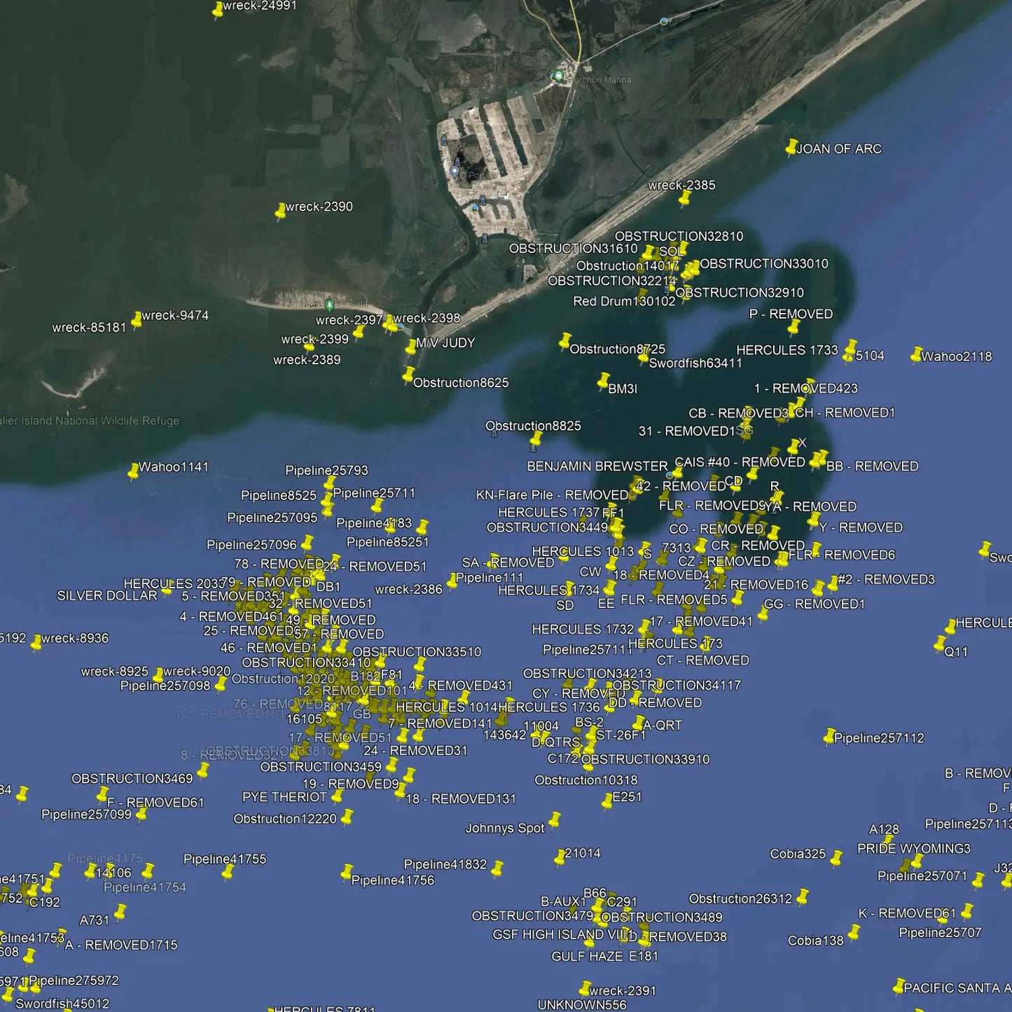
This extensive Grand Isle Fishing Spots package contains more than 2,100 fishing spots along the Louisiana coastline to approximately 15 miles offshore. Spots range from Cailou Bay in the west to just east of Grand Isle. This package includes many removed oil well locations, pipelines, public reefs, and private spots sourced by our team.
Anglers can confidently cast their lines on our spots and reel in a diverse array of sought-after coastal species, including but not limited to Snook, Redfish, Black Drum, Black Seabass, Sheepshead, and Grunts.
Compatible with Garmin, Simrad, Lowrance, Raymarine, B&G, Humminbird and Furono MFDs. Also, the apps from those manufacturers, Any mobile device or tablet running GPS Mapping software like Active Captain, Navionics, Aquamaps, Base Camp, GPX Studio, Google Earth, and many others.
Why Grand Isle Nearshore Waters Stand Out
Grand Isle Fishing Spots are known for consistent nearshore action, making them a smart choice for anglers who want productive water without running far offshore. This product focuses on the areas where bait gathers, current moves cleanly, and fish feed with purpose. Grand Isle’s mix of passes, rigs, reefs, and coastal edges creates reliable opportunities for both novice and experienced fishermen. By understanding these nearshore numbers, users can plan trips more efficiently, target better structures, and increase their chances of finding active fish in less time.
How to Use the Nearshore Numbers Effectively
The nearshore numbers included in this product help anglers narrow their search and spend more time fishing in the right places. Instead of guessing, you can move directly to spots with strong signs of life, such as moving water, depth changes, and bait activity. Grand Isle Fishing Spots often produce best when matched with the right tide, wind, and time of day, so these details matter. The information is designed to support better route planning, smarter drift decisions, and more confident targeting of productive nearshore water throughout the season.
Built for Practical, Real-World Fishing Trips
This product is created for anglers who want useful fishing information that works in real conditions. Grand Isle Fishing Spots are more than just names on a map; they represent proven areas where fish tend to gather when the conditions line up. Whether you are chasing speckled trout, redfish, or other nearshore species, having dependable spot guidance can make each trip more efficient. The content helps reduce wasted time, improve your setup choices, and give you a clearer path to better results on the water, especially when fishing Grand Isle’s active coastal environment.
Helpful for Planning Safer, Smarter Outings
Good fishing starts with good planning, and these Grand Isle Fishing Spots support that goal by helping you focus on practical, high-value nearshore locations. Knowing where to begin can save fuel, cut down uncertainty, and help you stay within comfortable range for the day. The product is especially useful for anglers who want a balance of performance and convenience while fishing Louisiana’s coast. With better spot awareness, you can build more organized trips, adjust to changing conditions, and make more informed choices before and during your time on the water.
Our files are sold as either digital downloads or delivery via SD Card. If you need an SD card shipped to your door, select the Yes Option for SD Card Delivery. If you order an SD card you will not receive a download link. Our shipping options include Ground UPS, Second day or Next Day Air Options. We also have FedEx available.
For other plotters (Raymarine), choose Garmin. GPX compatibility is 100%.
Package Price
Discount available for our heroes. Military, First Responders, Medical Workers and Teachers qualify for 20% off at checkout. Our Way of saying thank you!
 Get Verified
Couldn't load pickup availability